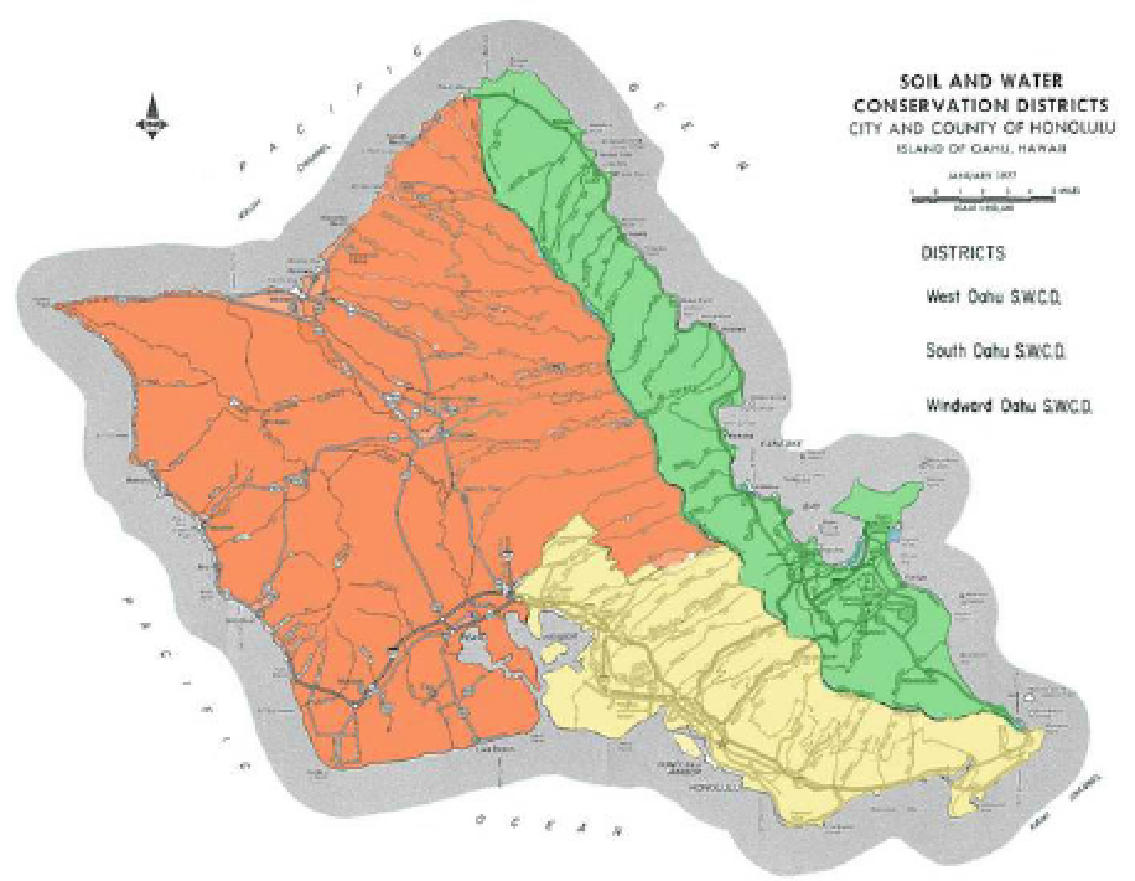

West District
The high-level uplands of Pupukea and Paumalu have historically been better suited for pineapple. The legend told in ‘Opana states that the gods Kane and Kanaloa gave life to Lawela Bay through water struck from Waikane. The gulches and streams that provide that water, however, were never historically planted or terraced. (Handy and Handy, 1971)
The Waimea Valley (reddish water), currently popular for its surf, was an intensively cultivated, and received water from streams stretching into the back of the valleys in the south-west watershed of the Ko’olau. The lower valley consisted of wetland taro and witnessed characteristic and frequent flooding. The largest wetland taro area was known as Ka’ili’ili, situated on land elevated above the stream bed. Houses were marked with existing bread fruit trees along the ridge, and there is thought to have been taro, sweet potato, sugar cane, banana, breadfruit, coffee and kava cultivation, historically. Likely grown for the ali’I nui who lived in the area. (Handy and Handy, 1971)
Wahiawa is known to be one far from the sea in any direction, and also one of the few places where sweet potato was historically grown with irrigation. In addition, yam plantations and terraced taro drew water from the Wahiawa Stream. West of Wahiawa and southwest of the upper end of the Waialua River is the head of the Kaioea and Waikoloa streams, which feed the Waialua River. This waterway provided a means for fisheries and terraced taro cultivation. More recently historically, Waialua provided sugar cane and taro. (Handy and Handy, 1971)

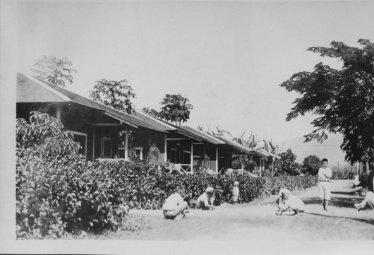
central oahu ca 1935-uh library "aloha hawaii scrapbook"
The Waialua Sugar Company, established in 1889, created a highly distinguished waterway system, drawing from both ground and surface sources, and providing water through their interconnected ditch system incredibly effectively. The four surface water collection systems, built between 1900 and 1906, delivered billions of gallons of water a year, and effectively the largest water storage capacity in Hawaii. These systems include currently function systems such as the Wahiawa-Lake Wilson system, Heleman and Opaeula and Kamananui systems. The parent company, Castle and Cooke, later announced the closing of the Waialua Sugar Company in 1995. (Wilcox, 1996)

"James D Dole" ca 1900- UH Library "hawaiian photo album"
In the lowlands of ‘Ewa, numerous streams fed wetland taro and pearl oysters. Lower parts of the valley have been known to grow yams and bananas and, more famously, kava. In addition, ‘Ewa supplied mamaki, wild bananas, coconuts and yams, and possibly the first breadfruit planting at Pu’uloa. (Handy and Handy, 1971)
‘Ewa was also the establishment site for the O’ahu Sugar Company in 1897. Initially, lowlands were irrigated with water pumped 550 up from the Pearl Harbor aquifer, and was later engineered to come from the Waiahole Ditch Plan in 1905. This plan required a start at a 790 foot elevation in Kahana Valley, and then to the back of Waikane and Waiahole Valleys , and moved water to the Wai’anae mountain range for a total of 21.9 miles. In 1912, the Waiahole Water Company was formed in order to establish the logistics of such a huge undertaking. This irrigation system was almost entirely made of tunnels, ranging from the shortest at 280 feet, and the longest at 3,329 feet. (Wilcox, 1996)

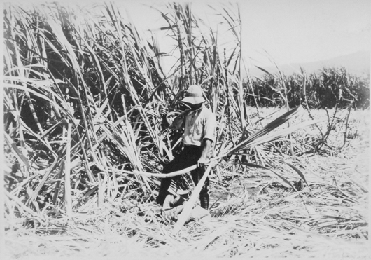
central oahu ca 1935- uh library "aloha hawaii scrapbook"

central oahu: ca 1900-- uh library "hawaiian photo album"

Central oahu ca 1900-uh library "hawaiian photo album"
Unlike the generously bestowed slopes of Waialua, the Wai’anae district is a dry costal strip with small streams and rocky mountains. The crop of choice in this area depended more on the sea, as well as a small crop of taro and sugar cane, when streams are found along the Wai’anae-kai valley. Although Captain Vancouver had noted in his travels to have been fed, “a number of hogs, and a great variety of vegetables.”, his initial description of the Wai’anae coast was,” one barren, rocky waste, nearly destitute of verdure, cultivation or inhabitants…”. Perhaps he never gave it a chance. (Handy and Handy, 1971)
In 1899, the Oahu Sugar Compant Ltd. (a subsidiary of Amfac/JMB Hawaii) began operating 13,441 acres of sugar cane land from Central Oahu, off Kunia Road, and portions of the Ewa Plain to produce 94,414 tons of raw sugar in 1897. In addition, the OSCo molasses output totaled a net 17 million kWh of electric power to Hawaiian Electric Company. (Decision Analysts Hawaii Inc, 1989)
The Poamoho Farm of the University of Hawaii was put into operation in 1937 for the investigation of soils, tree crops, and forage and truck crops on 31 acres. At this time, crops such as coffee, rubber, cotton, sisal, taro, bananas, rice, and honey were all important agricultural crops. Some minor crops included wine grapes, cassava, mulberry (silk), and cacao. (Krauss, 2003)
CA 1926-uh library "hawaiian photo album"
Beginning in 1896, the Waialua Sugar Company Inc. (a subsidiary of Castle and Cooke, Inc.) milled sugar gown on the north shore, between Waimea Bay and Dillingham Air Field, and extending into Central Oahu. In 1987, 65,895 tons of raw sugar was produced from 12,248 the total acres of land. In the late 1980’s, the Waialua Sugar Company Inc. also investigated the economic feasibility of growing marine shrimp. (Decision Analysts Hawaii Inc, 1989)

Thank you to the UH Library for hosting these wonderful historic photos used for our "SWCD History" section.
More information about the UH Library Historic Photo Collections can be found here: